3/22/14
“I could
disappear into this wilderness, get lost in this canyon and not another soul
would notice…they would tip their hats and shrug, my name left as only a
whisper. There is a fear in desperation
in the desert times of life, the moments we step on unstable ground, bruised and broken. I strain to breathe in the dry air, stifled
by the heat, realizing that the crossroads I am walking is dark and
obscure. Many of the things I thought I
knew about my life, my path are ethereal ghosts of a past that never became a
future. I straddle this harsh and
beautiful land realizing that I am alone in this place, there is a coldness in
the human race while the sun burns the skin.
The maze of life is infuriating at times, yet standing on the precipice
of the windswept bold cliffs of the canyon lands, seeing the vista of a hundred
miles of spectacular scenery, I turn from worry and hopeless despondency to the
flight of a phoenix, faith in the test, resilient in the paradoxical peace of
the wild, furious and raging – the wild has a deep soul, a window into heaven
and the perspective to embrace the light of life’s wonder with bold
trepidation.”


There
is a flight of the spirit in this canyon country, a place of deep
reflection. I have been through many
stressful events and constant upheaval the past ten years including my car
accident to broken dreams and a maze of uncertain circumstances. At times my life has been like a canyon,
twisting and turning, tumultuous uplift, floods and drought…standing in
firelight of the flaming red rocks of the Vermillion Cliffs in the contrast of
the desert and forests, hope is found in desolation, beauty in the color of
rocks and peace in the turbulent streams, fire dance in the grasses…this is a
land of contrast, it is the contrast that makes the landscape so intriguing and
spectacular – the desert is dry yet life persists and the spectrum of warm hues
stirs creative motion.
We stopped briefly for gas in Kanab, a
crossroads for travelers going from the North Rim and South Rims of the Grand
Canyon. Kanab lies in the dominion of
sky high red cliffs – so rich and deep in color – the hues are hard to
reconcile with reality. The reds are so
vivid that even a painter could not invent such an explosion of reds. It is a real life impressionist work,
nature’s artistry on bold display in a lost land, a land in a rural and
forgotten sort of place…beauty is often found in unexpected places, look
closely and you will see it in the glean of the morning light and banner of the
far reaching crowds.
Kanab
is a tourist town located just north of the Arizona and Kaibab-Paiute
Tribal Lands. Kanab is a gateway to
unbridled adventure. Kanab’s ‘backyard’
includes hiking slot canyons in the Grand Staircase of the Escalante and The
Wave in the Vermillion Cliffs, Paria Wilderness, camping and relaxation in Pink
Sand Dunes State Park…the recreation possibilities are diverse and
endless. This is some of the remotest area in the contiguous United States,
each backcountry hiking trail a passport to another world, a supernatural land
of sandstone monuments, delving into millions of years of geologic history and
ancient cultures left as remnants in stone and chards of pottery. Ironic that it is this harsh edge, the
extremes of this wilderness that exudes peace and solitude that can heal the
brokenness of a soul and offer hope even in the lost lonely canyons and rough
waters and dry basins…
Kanab is nicknamed ‘Little Hollywood,’
having served as the backdrop of 1939 John Wayne film ‘Stagecoach’ and the hit
TV show The Lone Ranger. The scenery of
the red rock mesas does evoke images of the wildest of the west, the manifest
dreams of adventure and high noon sun to the sunset shadows that frame the
canyon’s dazzling flaming edifices of old.
Kanab is also home to the largest
animal rescue sanctuary in the world, Best Friends…
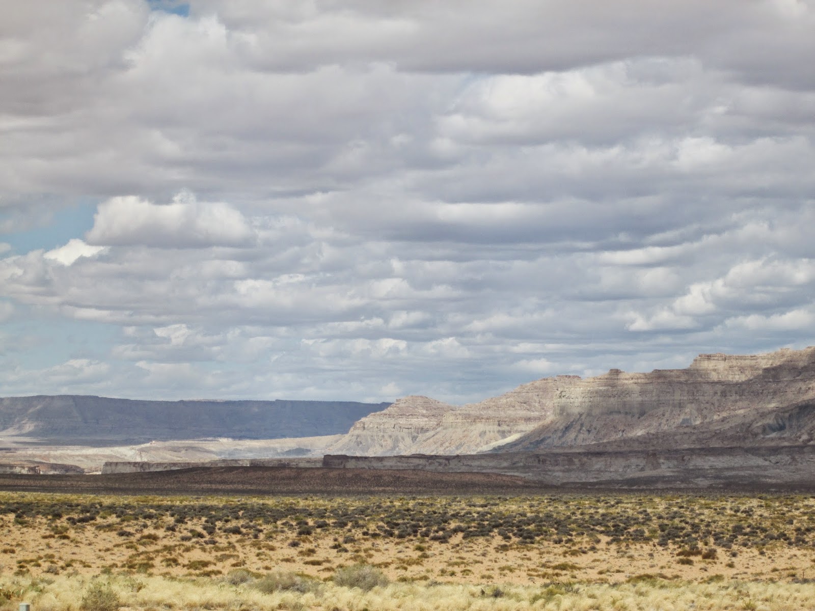
This section of Highway 89 is
dominated by the sheer red sandstone giants.
Vermillion Cliffs are the second step
in the five step Grand Staircase of the Escalante, a series of geologic layers
on the Colorado Plateau. The cliffs are
comprised of deposited silt and desert dunes, cemented by infiltrated
carbonates and intensely colored by red iron oxide and other minerals,
including bluish manganese. The Cliffs
are protected both as a wilderness and National Monument. Top attractions: The Wave, Coyote Buttes,
Paria River, Lee’s Ferry.
Traveling through the Vermillion
Cliffs, the language of the land, spoken in the multifaceted hues of scarlet
and cinnabar, pinks and soft rogue crimson, contrasted by the arid prairie
plateau, from wildflowers to muted grasses, cacti and yucca…It is a mosaic for
the eyes, an interconnected tapestry of geology and wonder. Each frame of movement on the highway a
picture that can rival any masterpiece of art – nature never ceases to amaze.
Highway 89 cuts through the heart of
the red rocks of southern canyon country, entering into the lower portion of
the Grand Staircase of the Escalante N.M. This section of road transforms into
a ‘dune’ desert – something so strange and miraculous in appearance that it
looks like a set from an episode of Star Trek…long expanses of bizarre desert
landscapes, badland formations and the
heat of the sun rising like a mirage.
The oddest portion of this journey began in the town of Big Water. The name it itself is ironic considering at
first glance you are practically stranded in the middle of a desert with not so
much a drop of water in sight…suddenly massive boats – are seen dotting the
landscape while advertisements for beaches and water recreation skirt the side
of the road on 1970s style highway signs.
Strange as it may seem gazing in this arid expanse, hidden from view is
Lake Powell, one of the largest manmade lakes in the world. Out of the desert, water is deep and wide,
staring off into the blue of the sandstone abandon, a whisper tells the story
of a lost legacy. Some say this area is
haunted, haunted by the ghosts of a past wonder lost to the reservoir, a canyon
to rival other canyons disappeared as a place no one knew…an ecosystem forever
changed from Utah to California. The
Colorado River is the lifeblood for the Colorado Plateau into the Great Basin
and Southern California. These dry, arid
desert lands depend on the Colorado River for moisture to feed the ravenous
heat. The Colorado River system is
complex, yet a perfect orchestra of nature.
Even disastrous flooding that periodically mars the river, is essential
to protecting native species of plants and animals.
Glen Canyon Dam and Lake Powell remain
a highly contentious topic in the Southwest.
The dam was created by flooding an area described as ‘Eden of the
Southwest,’ – The Glen Canyon, for use as a reservoir. It later became utilized for
hydroelectricity. Glen Canyon remains a
land lost under the flood of the Colorado.
I have mixed feelings about the
dam. The lost beauty of such a
remarkable canyon and the detrimental damage to ecosystems dependent on the
natural flow of the Colorado River, makes the dam a tragedy. On the other hand hydroelectricity is far
better than coal, natural gas or oil.
The reservoir provides water needs for Utah, Colorado, Arizona and New
Mexico…water is a precious resource here and tough decisions need to be made at
times and at least this one is not drilling for natural gas or use of oil…on
the other hand, the river’s inability to flow freely has repercussions in
California and in many of the ecosystems that creates strong biodiversity along
the Colorado River. In hindsight I think
the government acted too swiftly and selfishly in creation of the dam. The advocates said that ‘man is the highest form
of superior being’ using our superiority as a reason for having the right to
alter the landscape for human needs. I
oppose that statement to the highest degree.
We are fallen, broken creatures that learn humility through grace and
lessons in mistakes. I do agree that
natural resources should be used, but not when you sell your soul for the
resource. We need to be stewards of the
land. Ancient peoples who overgrazed and
misused the land suffered from drought, famine and other issues related to
consumption based land management. I
think Lake Powell is a reflection of difficult choices, special interests…it
has its benefits – hydroelectricity and drinking water and recreation…still
even supporters of the dam much acknowledge the sacrifice made for our
consumption. The loss of an earthen
Eden. The trace an Atlantis pulled under
the waters of the Colorado, buried in the waters of the lake.
Crossing into Arizona the road tossed
and turned our car around in the wind and sporadic potholes. We crossed the Glen Canyon Bridge, one of the highest bridges in the world,
a lingering glimpse of the raw undaunted Glen Canyon lit up the gorge below,
fire reds and hues of blacks to flaming sandstone coupled by the sheer drama of
the depth of the canyon and natural power of the Colorado to carve the
rocks…you gasp in humble awe…
The highlight of Glen Canyon area was
Horseshoe Bend. Setting eyes on this
intricate, bold, massive, colorful, dazzling meander of the Colorado River is a
scene so perfect it cannot be real. The
jagged rocks contrasted by the smooth chiseled sandstone and roaring rivers of
the Colorado is proof that magic exists.
Magic exists in the stratified layers of wind and rain, sediments of
past lives of the landscape. Science is
magic, so perfect is this scenery that it is a divine creation. I imagine God patiently and painstakingly
building this monument of time and wonder, carefully carving until ‘It was
good’ - using science as the tool for building.
Horseshoe Bend lives up to its name, it is literally a leg of the canyon
that twists in the shape of a U, Horseshoe, with 1000 ft. walls scaling from
the clouds to the abyss of the canyon and the gushing Colorado. The drama of stone stands strongest in the
monolith of red sandstone in the center of the canyon…it lives up to its names
as one of the prettiest views in Arizona.
The town of Page is a hub for the
area’s tourism and services for the northern reaches of Arizona and
south-central rural Utah. The town was
founded in 1957 as a housing community for workers and their families during
the construction of the Glen Canyon Dam.
The city is perched atop Manson Mesa and is 4300 feet in elevation. With the completion of Lake Powell in the
1960s, Page has become a bustling community with a vibrant culture of Navajo
influences, recreationists, dam workers and canyoneering and backcountry
enthusiasts. Page is surrounded by the
supernatural beauty of desert, mountains and monuments of stone and exquisite
canyons. Page is a vacation destination
in its own right, with an abundance of hiking trails, rafting adventures,
Navajo tours, the Vermillion Cliffs and Grand Staircase…in many ways Page is
the crossroads of canyons, a core of the Grand Circle (area of 40 national and
state parks in the four corners region) and a gateway to the Grand Canyon
(North Rim and South Rim are within two hours).
Page is home to Antelope Canyon, considered the most magnificent slot
canyon in the world. Antelope Canyon’s
smooth sandstone walls and mystical hidden nooks is a must see experience. It is the sort of experience that can
transport you to another dimension.
Words can only describe in the language of men, Antelope Canyon is
writing in the language of God and human language fails to master the eloquence
of nature, it is a wind that blows faster than the speed of sound, we capture
its essence and even then we too are always discovering the wonder hidden
obscured in slot canyons like Antelope, beckoning us to explore, to the
plainest beauty of the mesa flats and dry desert. Stepping into the wild pristine of Antelope
Canyon, is a spiritual experience. It is
a place of solitude and recognition – an echo of the waters of the past that
shape the future, life’s transforming power and the humility of grace in the
his natural cathedral, filled with light, such that even the shadows in the
canyons offer a quiet place of rest.
Antelope Canyon is a sacred place to
the Navajo. They manage the canyon as a
Navajo National Park and to enter this sacred place you must arrange a tour
with a Navajo Guide: http://www.navajonationparks.org/htm/antelopecanyon2.htm#lac
Lake Powell is a popular area for
boating and swimming, with nearly 3 million visitors per year to the
reservoir. One of the natural gems left
untouched by the flood is Rainbow Bridge.
Once a long backcountry hike, boaters can dock with a mile from the
colorful arch. It is one of the largest
natural bridges in the world (yes it is a bridge versus and arch, which are
formed by different types of erosion.)
Arizona is a beautiful state, with an
odd set of laws and infrastructure. I
love the natural grandeur of the state – unfortunately the state will leave me
‘dangling’ on its canyon walls, dreams rushing away as the fast a flash flood
of the Colorado River and quicker than a dust storm powering through the desert
sun.
Highway 89, is the ‘Golden Road,’
arguably the most ‘beautiful highway in America.’ It runs N-S for 1252 through scenic byways
offering windows into the heart of the American west, from Glacier National
Park in Montana, Yellowstone and Grand Teton in Wyoming, near Bryce Canyon UT
south to Page AZ and the North Rim of the Grand Canyon (connector 89A) to
Flagstaff Arizona. I have driven the
greater portion of the golden road…a road that has captured the spirit of my imagination
and speaks to the voice of the resplendent wild beauty of America, a beauty men
wrestle with and try to subdue, tearing down forests and damming rivers…still
this land is a paradise on earth.
My soul is revived in traversing the
rolling ambling pavement of 89. It is an
artery to byways, dirt roads and backcountry adventures. It is a road for dreamers. That is why it was disheartening when we
arrived in Page to learn that 89 is closed indefinitely due to a rock slide
that severely damaged the road. The
signage for this detour was poor and I really think it should have been the
first clue as to the priority Arizona places on maintaining its roads. I was about to bear the brunt of Arizona’s
negligence in managing this detour.
I will segment this section of our
journey into two distinct parts: ‘the accident’ and ‘sacred scenery.’ ‘The accident’ cannot take away from the
scenery and magic of the Painted Desert badlands of the Navajo Nation. I have an immense respect and admiration for
the Native Americans of this land; their legends, living traditions, and
culture is a heartbeat that pumps the four corners to life as much as the
foundation of the colorful rocks of the plateau and the life-giving waters of
the Colorado River.
With our goal of reaching the Grand
Canyon Desert View Entrance by four o’clock (Arizona time: AZ does not observe
daylight savings time, so it is an hour earlier there than other MST zone
states, which in this case worked to our advantage). The detour signs led me to believe that it
was safe to drive the alternate route with no problems. It is marked as an alternate, yet maintained
road. It turns out that this leg of the
road is a recently paved, makeshift highway from an old Navajo dirt road that
was for reservation use only. It is a
limited use road, marked as a major alternate route. I am going into detail about this because
Arizona’s lack of signage and explanation about the alternate route is going to
lead to severe car damage, of which we are still dealing with the repercussions
of a week later.
In the middle of Alt Route 89, a sign
warned of Rough Road, specifying a Speed Limit of 65. Arizona drivers were speeding by, but I
maintained my speed at 63 miles per hour, cautious and focused on the pavement. I have driven over ‘rough roads’ on a highway
before, but this road was a buckled disaster of ditches, potholes, hastily laid
pavement that made a carriage ride at high noon on the Oregon Trail smoother
transport. I still trusted that it was
safe to drive the road, as Arizona did not specify ‘Trucks and 4x4 only.’ So I drove and within minutes on the rough
road, I heard a loud bang as we hit a ditch in the middle of the highway,
scrapping and a whistling sound ensued.
I pulled over to see if anything was wrong with the car, feeling as if a
rocket had blown out our tire. It seemed
on first glance everything was fine. It
was extremely windy and I tried to quell my nerves about the ‘blast’ by
chocking it up to the wind. The scraping
returned as we neared the west entrance of the Grand Canyon…It was then, at the
Tusayan Ruins, I realized our fender liner was completely torn off and the
bumper damaged by the car. I went into
panic and resolve mode. The liner was
dragging so we cut it off so we could at least finish driving around the park
and then get to Flagstaff….so begins the saga of the fender liner….a saga still
in motion…you will have to stay posted to this blog for this Route 66 soap
opera.
~
Grand is the canyon, the symphony of
color, the mosaic of time, the figment of imagination into creation sublime,
the stories of old, the haunting lure, of the wide deep chiseled grand
gorge. Grand is the place that captures
the light and shadow, where storms rage and the sun dances as the clouds
converge…Grand is the place where the waters carve the earth’s epic tale in
winding cliffhangers and hidden caves, treacherous and calm waters…for grand is
this canyon we feel so small, yet our life is reflected in the pores of this
place. Such beauty build by painstaking
trial, storms, floods, earthquakes and time, time passes by silently or roars
to a standstill, moving in the colors of the teal blue Colorado and the flaming
reds of the Grandest Canyon of them all.
To refer to ‘The Grand Canyon’ as
grand is actually an understatement. I
could search every dictionary and thesaurus for an adjective, a title for this
wild land, its dangerous beauty…I could paint a thousand pictures, snap a
million photographs and still the vocabulary and pictures pale in
comparison. The Grand Canyon is more
than a mere canyon, it is a network of 270 miles that winds, cuts and rambles
into the paradox of order and chaos. One
look at The Grand Canyon and the roaring Colorado blazing through the
meandering twists and turns, feverishly cutting and carving history and future
merging as one. Motion and stillness in
the mastery of the silence of the breath of the Grand Canyon. It goes beyond a spiritual experience…it is a
pinnacle moment, the sort of metaphorical climb that puts things into
perspective. In the coming weeks I will
be doing a series of travel features on tips for touring the canyon, but in
this entry I want to simply recount the dancing of light on the canyon, the
haze of pollution contrasted with the foundations of nature’s wonder, the ruins
of a past civilizations to the present drama of the canyon. The canyon is ever changing all the while
timeless. It is magic and mystery…it
reveals its secrets to you with a bold power at first glance…some layers cut
and sear, others are soft and invigorating in the tempest of the canyon.
Seven miles outside of the entrance to
Grand Canyon National Park, we pulled over to view what I will refer to as ‘The
Narrows’ – the first glimpse of the canyon, spiraling towards something
greater, yet confined to the twists and turns of the journey to that ‘grand.’
At this turnout Navajo artisans sell
their work. Navajo are unparalleled in
their artistry from rugs that tell the spirit of the moment of the soul in
which they are woven to the fine silver-smith work...my mom and I are on a
budget and sadly could not afford to purchase much of the gorgeous jewelry and
artwork, but we enjoyed learning about the Navajo artwork. We purchased a hand painted Navajo Christmas
Ornament that speaks to the spirit of the Navajo Nation. I will always look fondly at our time in the
Navajo Country when we hang up this ornament in our new apartment. I am always eager to learn more about the
natives of this colorful and inspiring region.
We entered the park through the Desert
View entrance which is located on the eastern edge of the park. The name aptly describes the vast convergence
of the Painted Desert and The Grand Canyon.
The Painted Desert is a colorful
pastel hued 93,500 acre stretch of petrified sandstone badlands that dazzle
with their layers of deep violets, tangerine sun orange, fiery pink and flaring
reds. It is a light show, at times
subtle, other times hot as fire prompting one to get lost in the painting
before them. This is a harsh and
beautiful landscape, devoid of water, yet it is not barren…life has adapted and
the vibrant hues dare to prompt one to overturn their preconceptions about the
desert.


The Painted Desert is composed of
stratified layers of easily erodible mudstone, shale and siltstone from the
Triassic Chinle Formation. The colors
are revealed through the abundance of iron and manganese compounds that paint
the cliffs and mesas.
The desert is a result of a torrent
and tandem of multiple geologic forces working their creativity from volcanoes,
floods, earthquakes to wind and rain and fierce heat. The Painted Desert includes one of the
largest deposit of petrified rock in the world.
This rock is different than the petrified rocks of Yellowstone, the
petrified forest of Arizona is defined by colorful fossilization and variable
factors in the petrified process. I will
write a blog on the Petrified National Forest soon. It is a really neat off the beaten path gem
of a park (it is located off I-40 yet still often overlooked as speedsters
bypass its exit on the interstate.)
Back to the Canyon of Canyons. The first view of The Grand Canyon south rim
(add in about two rims) from the East is at the Watchtower. This vista opens up to the great divide of
vast canyons and pinnacle spires. At
first glance, your mouth gapes, ‘it’s beautiful,’ tearing up I took a moment
just to breathe it in, to allowing the spectrum of color and jagged rocks to
saturate my pores and fill my senses with the daunting grandeur of it all. It is not something I dare to fully capture,
rather I am content to stand in the splinter of sunlight and the shadow of the
canyon.
The Watchtower is an architectural
landmark designed by Mary Colter to mimic the Native American Anasazi legacy of
sandstone rock dwellings that blend with the land. Mary Colter is a genius of design; inspired
by the landscape of the southwest, Colter designed many of the buildings that
dot the South Rim of the Grand Canyon.
The tower allows an unparalleled view of the canyon.
My mom and I took time to stop at
Navajo and Lipan Points before stopping at the Tusayan Ruins, the foundational
remnants of an ancient Anasazi village that prospered in the Grand Canyon for
several centuries. I am fascinated and
in all of the ancient ones who lived in this land for nearly 1000 years before
abandoning their civilization, their ancestors remaining in the Zuni and
Hopi. The Anasazi were geniuses in
agriculture and water irrigation. They
build homes in cliffs and in the high mesa buttes of canyon country. They prospered through trade, farming and
tending the land. The secrets of the
Anasazi continue to elude the modern world, while the Hopi continue to pass
down the legacy of the myths and legends, reality and struggles of their
ancestors.
Tusayan is the remnant of a village,
offering a step back over 1000 years.
Standing among the ruins, if you are still enough you can almost hear
the voices of the past in the whistle of the wind, the busy market exchanging
goods and wares, the spiritual practices in the Kiva, and the agriculture on
the rim plateau…this was a civilization surpassing many parts of the western
world, including Europe – they thrived in the desert land. The ruins are a stark reminder that we are
but dust, yet our legacy does remain in the dust, while our spirit soars to
distant lands, mysteries of the past can be unlocked while some are meant to
lie in peaceful obscurity. Many
archaeologists speculate that tribes struggled from a drought due to
overgrazing…another lesson of the continuous flaws and triumphs of human nature
– if we cannot learn from the triumphs and failures of the past we will be
doomed to repeat the tragic lessons time wrote in the chards of pottery and
ruins of sand and stone in these desert hills.
The Tusayan Ruins is my favorite part
of Grand Canyon (aside from the rim itself), I fondly remembered touring the
trail ten years ago and was excited to share this archaeology with my mom. The ruins have a small history museum that
details the dig’s finds as well as the cultures of Native Americans in the
southwest and their culture’s interaction
with the Grand Canyon.
We learned about the plants and crops
the ancients grew on the land, saw their storehouse and home, kivas and outline
of their marketplace.
While at Tusayan, I noticed that the
rubber from our fender liner had come off the car, dragging on the road. The impact on Alt-89 in Page tore up our
bumper and fender liner. I was in a
frenzy of worry. My mom and I had to cut
off the part that is dragging. We lay on
the ground by Moran Point, working to at least keep the liner off the ground so
we could make it to Flagstaff. Of all
the places to have car trouble! My
anxiety was quelled by the flawless riddled view of the Grand Canyon. It takes patience,
testing and climbing life's slow arduous winding paths to create imagery like
this. When you face trial - remember the Grand Canyon and all the geologic
unrest to create this resilient beauty.


I
found peace in glory before me, nature’s creativity on full display. Grand Canyon is nature's symphony - the sonata at sunrise that
leaves you with its warmth at sunset.


My mom and I
stopped at the Grand Canyon Village General Store, where we purchased organic
turkey, cheese and chips for a dinner picnic.
Nerves dancing on rattlesnakes about the uncertainty of a car,
perseverance ignited in the vista of the canyon.
On the way to
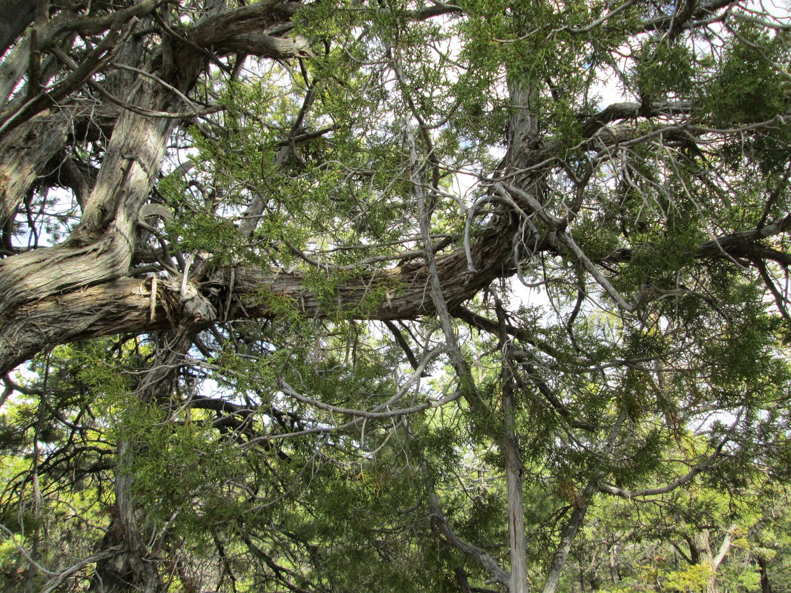
Flagstaff the sunset through the Coconino National Forest. It is interesting that out of this rugged
land lies one of the nation’s most diverse forests. Spanning 1.856 million acres the Coconino
National Forest is the largest ponderosa forest in the United States…the forest
includes tundra to desert climate. It is
an oasis unexpected in the heart of Arizona.
We arrived at
our motel just after eight o’clock.
Nerves roused about the car, which scrapped through I-40 from Williams
to Flagstaff, I phoned a dealership to see about getting the car looked at and
found out it would be at least until Monday to go to the Nissan dealership.
I fell into a
restless sleep dreams of climbing canyons, so close to the view ahead, yet the
future cloudy and reckless.


